
Everything You Need to Know About Surat Chennai Expressway
3.1K
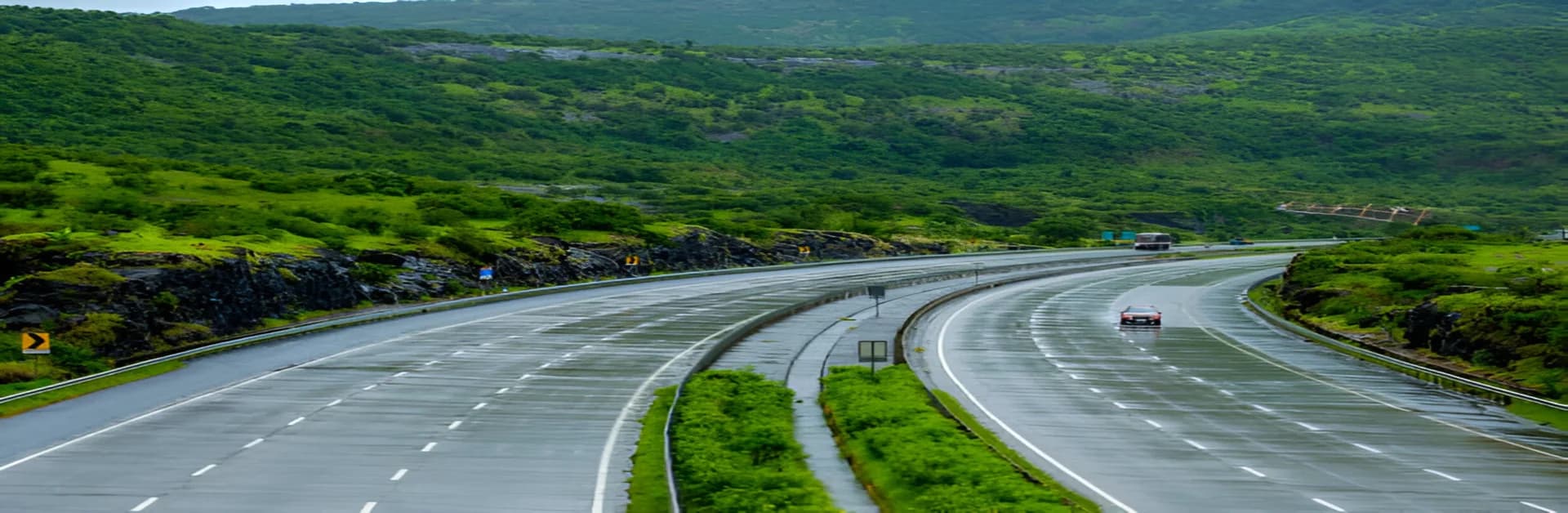
The Surat Chennai Expressway, spanning 1,271 km, connects key cities across six states, cutting travel time and boosting trade. This six-lane highway enhances connectivity, reduces congestion, and promotes tourism and economic growth. Expected by December 2025, it promises faster travel and regional development, transforming India’s transport landscape.
Contents
- Route Overview and Key Landmarks
- Benefits of the Surat Chennai Expressway
- Progress and Features
- Why Build the Surat–Chennai Expressway? National Connectivity & Policy Drivers
- Detailed Route Map of Surat Chennai Expressway
- Surat Chennai Expressway Estimated Cost
- The Final Word
- Frequently Asked Questions
- What is the real estate impact of Surat Chennai Expressway?
- What is the current construction status of the Surat Chennai Expressway?
- Will private vehicles or two-wheelers be allowed?
- Which cities will benefit most?
- What is the length of the Surat Chennai Expressway, and how does it benefit travellers?
- Which cities are covered by the Surat Chennai Expressway route map?
The surat chennai expressway is a transformative project under India’s Bharatmala Pariyojna Phase 2, connecting Surat and Chennai. Spanning 1,271 kilometres, it reduces travel time from 35 to 28 hours and the distance from 1,570 to 1,271 kilometres. Upon completion, it will stand as India's second-longest expressway. Cutting through key cities like Nashik, Solapur, Tirupati, and Kurnool, it bolsters connectivity across Gujarat, Maharashtra, Karnataka, Andhra Pradesh, Telangana, and Tamil Nadu.
Route Overview and Key Landmarks
The surat chennai expressway route map highlights two primary segments: the Surat-Solapur Economic Corridor and the Solapur-Chennai Economic Corridor.
- Surat to Solapur (564 km): The route blends greenfield and brownfield stretches, touching Nashik and Ahmednagar. Iconic locations like Saptashrungi Temple near Nashik add historical charm.
- Solapur to Chennai (707 km): A partially access-controlled highway links Solapur to Chennai, passing through cities such as Kalaburgi and Tirupati, home to the renowned Tirupati Balaji Temple. This alignment is also clearly visible on the surat chennai expressway map.
This strategic alignment avoids congested routes like Pune and Mumbai, providing a faster and seamless commute.
Benefits of the Surat Chennai Expressway
- Enhanced Trade and Connectivity: By directly linking North and South India, the expressway boosts industrial and agricultural supply chains. Cities like Surat, known for textiles, and Chennai, an IT hub, will see faster goods transportation.
- Reduced Congestion: The expressway diverts significant traffic from other highways, easing the burden on existing routes.
- Tourism Opportunities: Scenic views of the Western Ghats and easier access to landmarks like Tirupati Balaji and Kurnool’s Belum Caves will attract travellers.
- Economic Growth: New industries, retail outlets, and job opportunities are anticipated along the route. The surat to chennai expressway route map also indicates potential real estate booms in proximity to the expressway.
Progress and Features
Expected to be completed by December 2025, this six-lane expressway supports a design speed of 120 km/h. A mix of greenfield (newly constructed) and brownfield (upgraded) stretches ensures sustainable development. Noteworthy packages include sections in Maharashtra (Shahapur to Khamgaon) and Telangana (Singnodi to Julekal), reflecting the surat chennai expressway current status.
Why Build the Surat–Chennai Expressway? National Connectivity & Policy Drivers
The surat to chennai expressway is part of Bharatmala Pariyojna Phase 2, a nationwide plan to improve long-distance road links. By directly connecting western and southern India, it creates an industrial and trade corridor that avoids heavy traffic zones such as Mumbai and Pune. The Chennai Surat Expressway also fits into the larger vision of reducing travel times across states, supporting logistics, and boosting economic growth in both established and emerging hubs.
Detailed Route Map of Surat Chennai Expressway
The surat chennai expressway map shows two key sections
- Surat to Solapur (564 km): This stretch passes through Gujarat and Maharashtra, with important cities like Nashik and Ahmednagar on the route. A mix of new greenfield roads and upgraded brownfield highways make up this part.
- Solapur to Chennai (707 km): This section connects Maharashtra, Karnataka, Telangana, Andhra Pradesh, and Tamil Nadu. It passes through Kalaburgi, Kurnool, Kadappa, and Tirupati before reaching Chennai.
Together, these two corridors form a seamless 1,271 km route that cuts travel time from 35 hours to 28 hours.
Surat Chennai Expressway Estimated Cost
The Chennai Surat Expressway is one of the most ambitious highway projects in India. The overall estimated cost is between ₹45,000 and ₹50,000 crore. Of this, the Surat to Solapur section accounts for about ₹30,000 crore, while the Solapur to Chennai section requires about ₹15,000 crore. Built under the Hybrid Annuity Model, the expressway involves phased contracts across multiple states to manage scale and cost efficiency.
The Final Word
The surat–chennai expressway through major cities will play a critical role in shaping regional growth, with improved connectivity driving faster travel, industrial development, and investment. The expressway isn’t just a highway; it’s a catalyst for economic transformation and long-term prosperity.